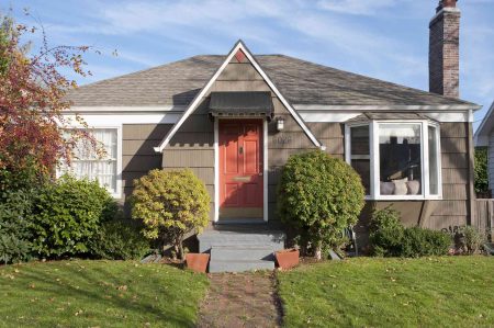
A land survey or property survey records the existing descriptions, measurements, topography, and boundaries of a specific property. They will also typically include any man-made structures, like a house, garage, or shed, and any appliances that are present on the property, such as underground plumbing lines or electrical lines.
Generally, land surveys are used when a new home is being built or when the property is being sold to provide up to date information to the new owner. However, land surveys can also be used to settle property disputes or for developers to subdivide the land.
The average land survey cost is about $525, though the price may range from $375 to $745, depending on the size, shape, and terrain of the property.
Meet the Expert
Crystal Olenbush is a real estate expert at AustinRealEstate.com and one of Austin’s top luxury realtors. She offers years of real estate knowledge and experience with land survey appointments, costs, and survey results.
Land Survey Cost Factors
Size
“In my experience, the aspect of a land survey that tends to be the most costly is the size and complexity of the property being surveyed,” says Crystal Olenbush, Realtor at AustinRealEstate.com.
On average, a land survey will cost about $0.50 to $0.70 per square foot, though the cost can increase depending on the difficulty of the terrain and the presence of any obstructions, like heavy foliage, leaves, or snow. In general, the bigger the property, the higher the overall cost.
- One Acre: $200 to $500
- Five Acres: $1,000 to $2,500
- 10 Acres: $2,000 to $5,000
Property Shape
The shape and dimensions of the property can also influence the price of the land survey. Simple square or rectangular properties are typically straightforward and easy to work with, but properties with odd twists, curves, or jutting property lines can increase the time it takes to complete the survey, leading to higher overall costs.
“Larger parcels and those with irregular boundaries, steep terrain, or dense vegetation usually require more time and resources from the surveying team, which can drive up costs,” Olenbush says.
For properties with more than four sides, homeowners can expect to pay about $50 per additional side, while more complex dimensions could incur additional costs.
Terrain
A flat lot with nothing but a house is easy and straightforward, but homes with multiple trees, bushes, dense foliage, uneven topography, or lots of underbrush will typically be more difficult and costly to survey. Homeowners will typically pay an extra $100 for every 10,000 square feet of hilled or sloped terrain.
The size and shape of the property, as well as the difficulty of the terrain can also increase the time it takes to complete the work, leading to increased prices.
“The time it takes to complete a land survey can vary, but on average, a standard residential survey typically takes one to two days from the initial site visit to delivering the final report,” Olenbush says. “However, larger or more complex projects may require one to two weeks or more.”
Research and Travel
The time spent on site conducting the survey is only a part of the job that needs to get done to provide accurate land survey results. The surveyor will also need to research the property deeds and other official records, while comparing these records against existing physical markers, like a fence, wall, or building.
Well-documented properties with clear, accurate information will take less time to research, leading to lower overall costs. Similarly, if the surveyor needs to drive a significant distance to reach the property, a travel fee may be added to the land survey cost. Work with the surveyor to determine what fees are included with the land survey estimate to avoid any surprises on the bill.
Cost Per Type of Land Survey
Boundary Survey
A boundary survey is considered one of the most basic land survey types, ranging in price from about $100 to $600, depending on the size, shape, and terrain of the property. This type of survey establishes the legal boundaries of the property and provides a measurement of the dimensions so that the current owner or new buyer can discover exactly how much real estate they own, which can influence the price of the property.
Topographic Survey
A topographic survey is intended for lots that are smaller than 10,000 square feet in size. The survey identifies man-made and natural features, including buildings, fences, streams, trees, ponds, and varying topographical elevations. This type of survey costs between $500 to $1,200 and is typically used by engineers, architects, or government agencies before developing a plot of land.
Mortgage Survey
Another common type of land survey is a mortgage survey. This type of land survey is typically requested by a mortgage company, lending institution, or a title company as a requirement of the financing and approval process. Homeowners will need to pay about $500 for a mortgage survey, and will receive detailed information about the property boundaries, size, and precise locations of any buildings on the lot.
Fence Land Survey
Similar to a boundary survey, a fence survey is intended to identify the boundaries of the property for the purpose of planning a fence-building project. Without knowing where the boundaries are, homeowners may accidentally build the fence across the property line, restricting the true property owner from a portion of their land, which can lead to property disputes. Instead of taking the risk and making a mistake, homeowners should pay $250 to $1,000 for a fence land survey before installing a new fence.
As-Built Survey
For an as-built survey, the surveyor will use a three dimensional drawing to create a representation of how the property would have looked at a specified point in time. Due to the amount of research and technical knowledge required to complete an as-built survey, the price for this type of land survey can be high, ranging from $800 to $1,200, on average.
New Construction Survey
Before building a new home on a plot of land, the construction company or developers will need to have a new construction survey completed for about $400 to $1,800. Similarly, if the homeowner wants to build a new addition, put in a pool, or add a garage to the property, a new construction survey will help identify the boundaries, topography, and any hidden utilities.
ALTA Survey
The most time-consuming and expensive type of land survey is an American Land Title Association (ALTA) survey, which costs between $1,200 to $3,000. This type of survey is also considered the most comprehensive type of land survey, which is why ALTA surveys are often purchased by commercial property buyers or homebuyers who are dealing with a title dispute.
Subdivision Survey
When developers or homeowners want to divide the existing plot into smaller parcels of land to build multiple domiciles, the property must first be subdivided. A subdivision survey, which costs between $300 to $1,000, provides the information necessary to accurately divide the existing property into subdivided plots. This type of survey is common for developers when planning a residential subdivision.
When You Need a Land Survey
While most people think of a land survey as part of the sale or purchase of a home, there are other circumstances where this service is necessary, including property disputes, new construction projects, land purchases, utility locating, and subdivision creation.
- Property Disputes: With adjoining properties and unclear property lines, homeowners may end up in a dispute with their neighbors, leading to unpleasant conflict, legal battles, and possible repair or renovation costs to move any objects or structures that cross the property line. “The main benefit of hiring a professional for this work is their expertise in accurately defining property boundaries and providing legally-defensible documentation. This can be crucial for resolving disputes, obtaining permits, and ensuring compliance with local regulations,” says Crystal Olenbush, Realtor at AustinRealEstate.com.
- New Construction Projects: Homeowners that want to put in a pool or build an addition to the home should get a land survey to identify the boundaries of the property and locate any possibly obstructions, like hidden utility lines. This also applies for developers who are building a new house on the land.
- Land Purchases: When buying a plot of land or a new home, it’s recommended to get a land survey. While the deed may describe the measurements and boundaries of the property, it’s best to get an up-to-date account of the land’s topography, boundaries, and any man-made objects or utilities.
- Utility Location: Randomly digging in the yard doesn’t seem like it would be a problem until you hit the main water line for the house or slice through the internet cable. A land survey can uncover these hidden utilities so you can plan construction projects properly and avoid accidental property damage.
- Subdivision Creation: Developers may purchase a large plot of land in order to subdivide it into smaller sections for multiple domiciles. A land survey will provide the exact dimensions and boundaries of the property, making it easier to plan accurate parcels of land.
Best Time of Year for a Land Survey
In many cases, it’s best to plan a home project during the fall or even winter months due to the lower demand for the service and potential bargains. However, when it comes to a land survey, the cost can actually increase during the fall and winter months because leaves, snow, and ice may obscure the terrain, making it more difficulty to complete the survey.
With this in mind, planning a survey for the spring or summer is often the best option. Speak to the land surveyors to find out when they are the least busy and if there is any cost benefit to booking during these off-peak periods, such as early spring or late summer, just before the leaves start to fall.
-
What happens if you don’t get a survey?
Not getting a survey may not seem like a big deal, but without this information there is a chance that any additions to the home, like a sunroom, fence, or even a new driveway, could cross the legal boundaries of the property, leading to property disputes, problems with the neighbors, and fines.
-
Can a survey be mandatory?
In some situations a land survey can be mandatory, such as if a mortgage lender or title company requires a land survey during the purchase of the property. Similarly, in a property dispute, a land survey may be required to establish accurate boundaries and settle the matter.
-
What are the downsides of a survey?
The main downsides of a survey are the cost, the time it takes to complete, and the potential for errors, which may be caused by poor weather, tough terrain, outdated property records, or simple human error. A land survey could also lead to a legal dispute with an adjoining property or costly repairs to correct an oversight, like needing to have a fence moved to reflect the actual property line.
Read the full article here


